Each day the IPMA in conjunction with the INCF publishes the rural fire risk chart by municipality.
In order to help prevent rural fires, it is important that everyone living or travelling in rural areas understands these as they explain what activities are allowed or not allowed. This is further explained in our Fire Prevention page.
The daily fire risk map showing the fire risk in your municipality can be downloaded here. English version
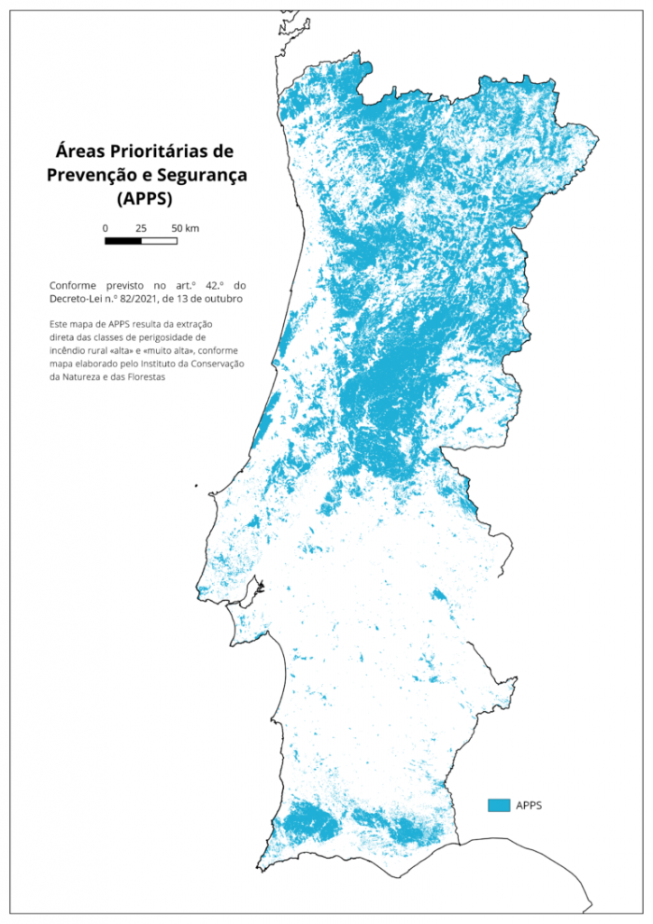
Priority Areas for Prevention and Safety (APPS)
With the enactment of Decree-Law No. 82/2021, of October 13, priority areas of prevention and safety were created, on which special protection measures, some restrictions and application of specific projects in action programs are applied at regional and sub-regional levels. As provided by law, these priority areas of prevention and safety, abbreviated as APPS, correspond to the “high” and “very high” rural fire hazard classes, based on the hazard map produced by the Institute for the Conservation of Nature and forests. The APPS are disseminated by the Agency for the Integrated Management of Rural Fires, on its digital website, and also by the municipalities, on their digital websites and in stylish places, for the broad knowledge of citizens. Articles 41, 42, 60 and 68 refer.
The law provides for the possibility for the Sub-Regional Committees for the Integrated Management of Rural Fires to add other areas to the APPS, in addition to those that result directly from the hazard map (cf. paragraph 3 of article 42 of the Decree- Law n.º 82/2021, of October 13 ), it should be noted that the version now published does not contain additional areas, these being the APPS that result exclusively from the «high» and «very high» hazard classes of the rural fire hazard map, as prepared and published by the Institute for the Conservation of Nature and Forests.
What are the Prevention and Safety Priority Areas (APPS)?
APPS are areas on which special protection measures are applied, because they represent territories with more favourable conditions for the progression of fires. The purpose of APPS is to minimize the probability of severe damage to people and their property, knowing that the territories where APPS are marked today are frequently covered by fires.